Be the first to know about the latest tips, exclusive offers, and insights
3D Mapping

March 17, 2026
Be the first to know about the latest tips, exclusive offers, and insights
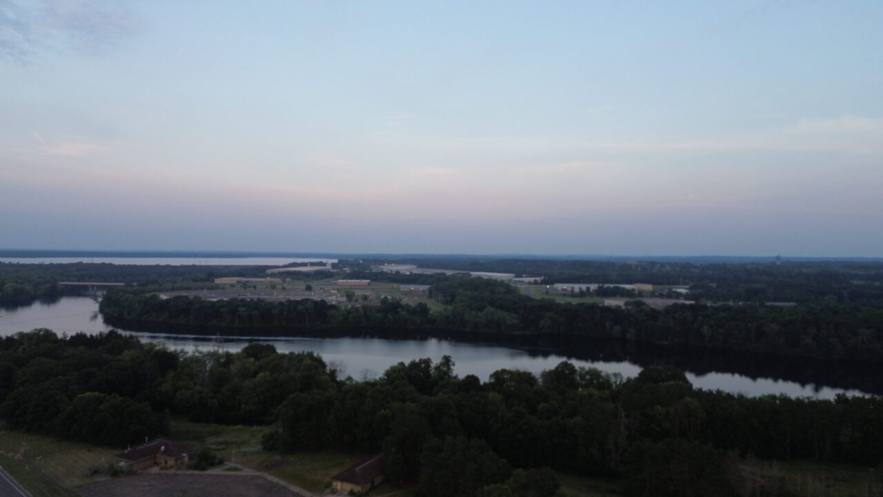
This aerial drone image captures a calm river winding through a dense forest landscape during early evening light. The elevated perspective immediately reveals the natural path of the river as it curves gently through the terrain. In the foreground, thick clusters of trees create a rich green canopy that frames the lower portion of the scene. The river reflects the dim sky, creating a smooth surface that contrasts with the textured tree line. As a result, the image feels both balanced and visually engaging.
Moving deeper into the composition, the landscape gradually transitions from dense woodland to more open and developed areas. Patches of cleared land and structured layouts begin to appear beyond the tree line. Industrial and commercial buildings sit quietly in the midground, providing contrast against the surrounding natural environment. This transition highlights how developed spaces integrate with nature. Additionally, a second body of water becomes visible near the horizon, which enhances the overall depth of the image.
The sky features soft gradients of blue and gray, suggesting dusk or early sunset conditions. Because of this lighting, the colors remain muted and natural. The subdued tones create a calm and peaceful atmosphere throughout the scene. Furthermore, the wide horizon line emphasizes the scale of the landscape and reinforces the sense of openness. The composition naturally guides the viewer’s eye from the wooded foreground, across the river, and toward the distant skyline.
This type of aerial drone photography effectively showcases both natural features and surrounding infrastructure in a single frame. It provides valuable visual context that traditional ground-level photography cannot capture. Therefore, it is especially useful for real estate listings, land development projects, and commercial marketing. It allows viewers to understand property boundaries, nearby water features, and surrounding land use quickly and clearly.
Moreover, the smooth flight capture and stable framing demonstrate the precision of modern drone technology. The image highlights how aerial imagery can transform a simple landscape into a compelling visual story. It also supports businesses that rely on high-quality visuals to present locations professionally. As a result, this image works well for websites, promotional materials, and digital portfolios.
Overall, this drone image delivers a peaceful yet informative perspective of the environment. It combines natural beauty with functional detail, making it both visually appealing and highly practical for a variety of uses.
Sky Story Productions is a Professional drone photography service West Central Wisconsin–based drone media company specializing in cinematic aerial photography, videography, and virtual tours, delivering high-quality visual storytelling for real estate, commercial, and promotional projects.
Copyright © 2026 Sky Story Productions.